

World Area Forecast System (WAFS)
Internet File Service (WIFS)
User's Guide
WAFC Washington
Version 9.1 — June 2026
Introduction
Legacy WIFS will be shut down in November 2028. Users are encouraged to use the WIFS API.
The International Civil Aviation Organization (ICAO) established the World Area Forecast System (WAFS) system in 1982 to supply meteorological authorities and other users with global forecasts of en-route meteorological conditions in digital form. The U.S. and the United Kingdom (UK) share in the global distribution of the WAFS forecasts required in ICAO Annex 3 and the operational meteorological (OPMET) information specified in the Facilities and Services Implementation Document (FASID) Table MET2A.
The U.S. distribution of WAFS forecasts and OPMET information is provided through the WAFS Internet File Service (WIFS). The UK distribution is provided through systems managed by the Secure Aviation Data Information Service (SADIS) program; formerly known as the Satellite Distribution System. WIFS replaced the International Satellite Communication System (ISCS) and is compliant with ICAO Document 9855, Guidelines on the Use of the Public Internet for Aeronautical Applications. The U.S. WAFS forecasts are provided by the Washington World Area Forecast Center (WAFC). The Washington WAFC is operated by the United States National Weather Service (NWS).
Through access to WIFS, States may wish to meet their obligation under Article 28 of the Convention on International Civil Aviation regarding the provision of meteorological services to facilitate international air navigation. Regarding the use of WAFS products, for example, ICAO Annex 3 specifically notes in Appendix 2, Section 2.1.1: “Aerodrome meteorological offices shall use WAFS forecasts issued by the WAFCs in the preparation of flight documentation, whenever these forecasts cover the intended flight path in respect of time, altitude and geographical extent, unless otherwise agreed between the meteorological authority and the operator concerned.”
WIFS provides access to authorized users as described in Accounts.
Data Available
Three types of data are available on the WIFS API: WAFS gridded data, WAFS Significant Weather forecasts (SIGWX) and OPMET data.
The WAFS data sets are produced by the two World Area Forecast Centres (WAFCs); WAFC London and WAFC Washington. The United Kingdom is both the SADIS Provider State and the WAFC London Provider State. Similarly, the United States is the WIFS Provider State and the WAFC Washington Provider State.
| Date | Version | Description1 |
|---|---|---|
| 14-Jul-27 | 9.2 | Expanded API information |
| 25-Jun-26 | 9.1 | Updates for WIFS API rewrite |
| 30-Jun-25 | 9.0 | Overhaul to focus on WIFS API |
| 24-Feb-25 | 8.0 | Added WIFS API Users Guide |
| 4-Feb-24 | 7.0 | Updated directory listings to show 0.25 deg data. Added links to API documentation where needed Added IWXXM data information Changed password update information |
| 14-Apr-22 | 6.0 | Changed Help Desk work hours from 7am-3:30pm to 7am to 3pm. Updated Appendix C, WIFS directory structure (fig. 6.1) to include 0.25 data, figure 6.3. Added section 6.2.2 |
| 4-Dec-17 | 5.0 | Removed any mention of GRIB1 data; changed all mention of “trial” forecast data to “harmonized” data, added expected data availability tables to Section 3; removed trial forecast designation for WIFS aviation grids; modified the directory structure in Section 6; modified Appendix A to include more information about how a user can use WIFS; moved GNU wget information to Appendix B. Added GRIB2 details to Appendix C. FL080 (750 hPa), FL210 (450 hPa) and FL480 (125hPa) were included in the Appendix C table for wind, temperature, RH, and height. Added sections on SIGWX and PNG corrections. |
| 28-Mar-11 | 4.1 | Modified Section 5 Data Retrieval Process to make it clearer and easier to interpret; this includes removing the site-specific URLs. Added reference to SADIS User Guide Annexes 1 and 4. |
| 14-Jan-11 | 4.0 | Document baselined after final reviews. |
| 4-Jan-11 | 3.1 | Added verbiage on authorization criteria. Updated document after review of v3.0. |
| 1-Nov-10 | 3.0 | Completed Draft Interim Version: Added introductory information Reorder sections for logical flow Added Chapter 2, WIFS Products and Data |
| 26-Aug-10 | 2.1 | Changed WIFS help desk phone number. |
| 15-Jul-10 | 2.0 | Folded in the contents of the WIFS Interface Control Document; added Appendix B, Reference Documents; expanded the GNU wget description in Appendix A; updated Section 3 Data Retrieval Process; added Appendix C WIFS Registration; changed link to software providers in Section 3; reorganized Section 4 based on reviewer comments; added new Section 4.3 Suspension of Access; added note to Section 5 that mentions potential harmonization of directory structures. |
| 20-May-10 | 1.3 | Based on technical interchange with customers, the GRIB data is now being served in a concatenated file format. The description of the file formats in Section 6 reflects this change. Based on feedback from reviewers: (1) Appendix A was added to describe the GNU wget utility, (2) Section 3 was modified to include a reference for Appendix, (3) minor changes were made in Section 4 to clarify back-up roles and responsibilities, and (4) Section 4.2 title was modified. |
| 26-Apr-10 | 1.2 | Based on feedback from reviewers: (1) section 2 was renamed “Service Overview and Responsibilities of U.S. Government Agencies”, (2) section 3 was renamed “Data Retrieval Process”, (3) backup information was added to section 4, (4) section 7 “Responsibilities of U.S. Government Agencies” was renamed “WIFS Customer Support” and is now section 8, and (5) more information was added to the WIFS Customer Support section including information on a trouble ticket system. |
| 5-Apr-10 | 1.2a | Based on feedback from reviewers, added “WAFC Washington” wording to title, footer, and the Introduction. |
| 30-Mar-10 | 1.2 | Based on feedback from reviewers, made some changes to the User Authentication fields. |
| 26-Mar-10 | 1.1 | Incorporated user feedback including: new document change history section, correction to Table 2 GRIB/GRIB2 description, additional descriptions where necessary, section heading changes, and more. |
| 24-Feb-10 | 1.0 | Initial draft release. |
Accounts
Authorization
The United States as a WAFS Provider State has agreed to support the operation of WAFC Washington along with the provision of making WAFS services available to all Contracting States as recognized in ICAO Regional Air Navigation Plans. WIFS is not an open system and requires all users to be approved for access by both the:
- ICAO State Meteorological Authority or the designated WIFS Approval Official registered with the ICAO Region and
- FAA as the ICAO designated Meteorological Authority for the U.S. and as a WAFS Provider State.
WIFS access is restricted to those individuals (or activities) who support meteorological services for the conduct or development of international air navigation. The following categories of users may be provided access based on submission and approval of a WIFS Registration Form:
- State Meteorological Authority and designated representatives
- State National Meteorological & Hydrologic Service Providers including Volcanic Ash and Tropical Cyclone Advisory Centers
- State Units supporting air traffic services, search and rescue services, aeronautical information services
- International Air Carrier Operators
- Meteorological Service Provider Vendors which provide meteorological services for International Air Carrier Operators
- WAFS Workstation Vendors
- Other Aeronautical Users (i.e., Any entity that is deemed by the State and the WIFS Provider State to have a need for WAFS services.)
- SADIS Backup User
WIFS Users are advised that their account may be terminated if it is determined the account is being used for purposes other than the original intent in support of international air navigation.
Primary Service Responsibility
WIFS SADIS
Registration
Approving an applicant request for access to WIFS requires submission and processing of a WIFS Registration Form as outlined in the following steps:
Applicant (Completes Steps 1 and 2):
Determines whether WIFS or SADIS is the primary service for obtaining WAFS forecasts for operational use as required in ICAO Regional Air Navigation Plans (RANPs) for their location. See map in the section above.
NOTE: WIFS provides primary service for North American, Central America, and Caribbean (NACC); and South America (SAM) Regions. WIFS and SADIS share primary responsibility in the Asia and Pacific (APAC) region as listed in the APAC FASID Table 6 (https://www.icao.int/APAC/Pages/edocs-fasid.aspx). Further information about backup procedures can be found below.
Completes and submits the WIFS Registration form online (https://aviationweather.gov/wifs/). Fields on the form with an (*) are required. Failure to provide accurate information may result in a processing delay or denial of a WIFS account.
Comments Section: Include a description of the intended use of the WIFS service indicating how that use relates to developing or conducting meteorological services supporting international air navigation.
FAA (Completes Steps 3 & 4 as the WIFS Approval Authority):
Reviews the WIFS Registration request and confirms the State Approval and/or the status of an existing SADIS account if the WIFS access is for SADIS backup.
Approves (or denies) the Registration request.
NWS/AWC (Completes Step 5 as the WIFS Service Provider):
Advises the Applicant of the status. If approved, issues a Password and User Name; and adds the applicant as an approved WIFS User (primary or backup).
API Access
Users need to obtain API keys in order access the WIFS API programmatically. API keys are managed via the WIFS account page (login using your email address). Keys are valid for one year and up to five keys may be active at any one time.
If you have a WIFS account but not web site access, register for an account and select WIFS API. Please use the email address associated with the account POC for faster activation.
Legacy access
Note: Legacy access will be shut down in November 2028. Users are encouraged to use the WIFS API.
Legacy WIFS services are accessed using the account name as a username and a password. Users may change their password by going to the WIFS website and clicking on "Manage Account" and clicking on "Change WIFS Password". Legacy access is no longer available to new users, and existing users are encouraged to migrate to the API during parallel operation.
Passwords must be at least 15 characters and must contain at least one: one upper case, one lower case, one digit [0-9] and one special character from "!@#$%^&*()".
Backup
In order for the SADIS and WIFS providers to appropriately manage and maintain viable, mutually existing services delivering WAFS forecasts, the following process should be followed within a particular State in arranging to obtain their data.
For Primary Operational Use from:
WIFS Primary Use:
- Applicants become approved WIFS Users; follow the procedures above for establishing a WIFS account.
- SADIS accounts will be provided to authorized WIFS users by the SADIS Provider State for backup purposes on condition that:
- A WIFS account has been authorized and provided;
- SADIS use is restricted to backup purposes and periodic testing.
- Follow procedures as described on the SADIS website
NOTE: Cost recovery is not required for a backup account provided the SADIS procedures are followed. Additional background is available in the SADIS User Guide/Part One
SADIS Primary Use
- Applicants become approved SADIS Users and participate in the SADIS cost recovery scheme as described in the SADIS User Guide.
- WIFS accounts will be provided to authorized SADIS users by the WIFS Provider State for backup purposes on condition that:
- A SADIS account has been authorized and provided;
- There are no outstanding balances in respect of the SADIS cost recovery scheme and
- That use is restricted to backup purposes and periodic testing.
Either SADIS or WIFS Primary Use:
For requests coming from the ICAO APAC Region, the State determines which of the two services (SADIS or WIFS) to obtain their primary operational access to WAFS forecasts; follow the appropriate procedures in subsections A or B above.
Both SADIS and WIFS Primary Use
In exceptional circumstances, States that have an operational requirement to obtain data from both WIFS and SADIS on a continuous basis will have their requests considered on a case-by-case basis. Under such circumstances a State taking both services will be required to contribute fully to the SADIS cost recovery scheme (unless recognized as a United Nations Least Developed Country).
The definition of the threshold for operational versus backup purposes to be used on the SADIS and WIFS Internet-based services was defined and endorsed by the ICAO SADIS Operations Group (SADISOPSG) and is described in the notes below. The policy limits backup access to a maximum of one day in seven. In the event of unavailability of the SADIS service, unlimited access to WIFS will be granted until the SADIS service has been restored.
Suspension of Access
User accounts and any associated API keys may be disabled after six months of inactivity. Please be sure to log in periodically and ensure contact information is kept up-to-date.
WIFS access may be suspended by the WIFS Approving Authority for unauthorized use of WIFS. Access to SADIS and WIFS as back-up services may be suspended by the WIFS and SADIS approving authorities if user’s primary WIFS or SADIS accounts are suspended. WIFS access may be suspended by the WIFS Service Provider for exceeding reasonable usage limits; please reviews restrictions and limits in this User's Guide further information.
Gridded Data
The WAFS gridded forecasts have a number of applications for users, e.g. to calculate specific leg winds for detailed flight planning, or to create charts of selected map areas or routes using visualization software. WAFS SIGWX forecasts are designed for situational awareness.
0.25-degree horizontal resolution
- Wind U/V - 56 vertical levels from FL050 to FL600
- Temperature - 56 vertical levels from FL050 to FL600
- Geospatial Height - 56 vertical levels from FL050 to FL600
- Relative Humidity - 14 vertical levels from FL050 to FL180
- Tropopause height and Tropopause temperature
- Max wind height, and max wind u/v
- Icing Severity - 26 vertical levels from FL050 to FL300 Turbulence Severity - 36 vertical levels from FL100 to FL450 Cumulonimbus Extent, Base and Top
1.25-degree horizontal resolution
- Wind U/V – 17 vertical levels from FL050 to FL530
- Temperature – 17 vertical levels from FL050 to FL530
- Geopotential Height – 17 vertical levels from FL050 to FL530
- Relative Humidity – 5 vertical levels from FL050 to FL180
- Tropopause height and Tropopause temperature
- Max wind height, and max wind u/v
Levels
| 0.25-degree horizontal resolution parameter | Vertical level |
|---|---|
| Wind (u and v components), temperature, and geopotential altitude | FL050 to FL600 at 1000ft vertical intervals Humidity FL050 to FL180 at 1000ft vertical intervals |
| Flight level and temperature of tropopause | These are not provided for specific levels |
| Maximum wind (u and v components) and height of maximum wind | These are not provided for specific levels |
| Icing severity | FL050 to FL300 at 1000ft vertical intervals |
| Turbulence severity | FL100 to FL450 at 1000ft vertical intervals |
| CB horizontal extent, CB base, and CB top | These are not provided for specific levels |
A limited selection of data is available based on a latitude/longitude regular grid at a 1.25° x 1.25° horizontal resolution for those unable to process those fields at the higher resolution and these are summarized in the table below. These parameters are available for 6, 9, 12, 15, 18, 21, 24, 27, 30, 33 and 36 hours after the time (0000, 0600, 1200, 1800 UTC) of the synoptic data on which the forecasts were based.
| 1.25-degree horizontal resolution parameter | Vertical levels |
|---|---|
| Wind (u and v components), temperature, and geopotential altitude | FL050, FL080, FL100, FL140, FL180, FL210, FL240, FL270, FL300, FL320, FL340, FL360, FL390, FL410, FL450, FL480, FL530. |
| Humidity | FL050, FL080, FL100, FL140, FL180 |
| Flight level and temperature of tropopause | These are not provided for specific levels |
| Maximum wind (u and v components) and height of maximum wind | These are not provided for specific levels |
Times
| Parameter | 1-hourly intervals | 3-hourly intervals | 6-hourly intervals |
|---|---|---|---|
| Wind, temperature, geopotential altitude | 6, 7, 8, 9, 10, 11, 12, 13, 14, 15, 16, 17, 18, 19, 20, 21, 22, 23 and 24 hours | 27, 30, 33, 36, 39, 42, 45 and 48 hours | 54, 60, 66, 72, 78, 84, 90, 96, 102, 108, 114 and 120 hours |
| Flight level and temperature of tropopause | |||
| Direction, speed and flight level of maximum wind | |||
| Humidity | |||
| CB horizontal extent, CB base, and CB top | 6, 7, 8, 9, 10, 11, 12, 13, 14, 15, 16, 17, 18, 19, 20, 21, 22, 23 and 24 hours | 27, 30, 33, 36, 39, 42, 45 and 48 hours | Not provided |
| Icing | |||
| Turbulence |
Regional Tiles
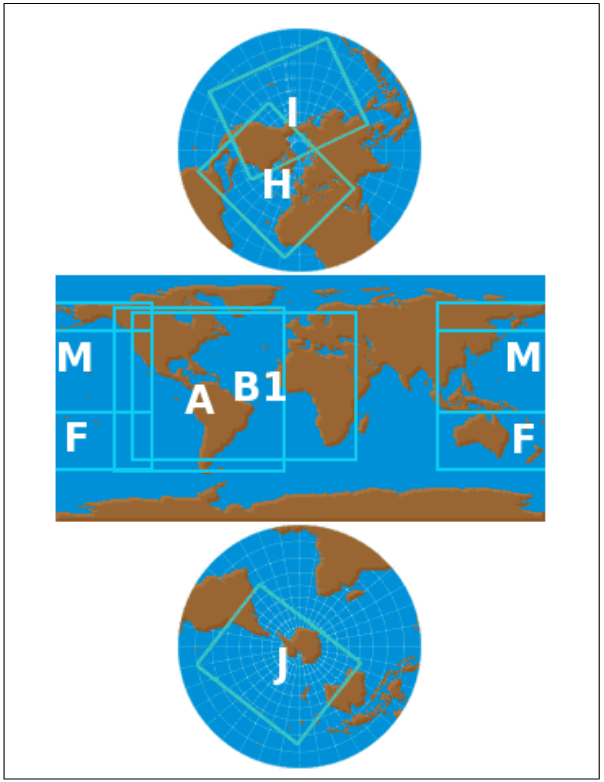
Gridded data is available on a global grid (G) or regional subsets (A#) as below:
Regions
- Europe - 30-90N, 30W-60E
- Africa - 60S-30N, 30W-60E
- Central Asia - 0-60N, 60E-150W
- Australia - 60S-0, 60E-150W
- North America - 15-90N, 150W-30W
- South America - 60S-15N, 150W-30W
- Siberia - 60-90N, 60E-150W
- Antarctica - 90-60S, 180W-180E
Obtaining Data
WAFS grids are available through the WIFS API by querying collections and items as outlined below. Some datasets may be retrieved via file listings using legacy WIFS.
Authentication is required — see accounts for access information and API for how to supply authentication with requests.
In accordance with the OGC-EDR API framework the WAFS gridded data is organized into a series of collections. A request for https://aviationweather.gov/wifs/api/collections will return a JSON format file which describes all the available collections as well as range of metadata relating to each collection. The available collections are shown in the table below. Data sets for both WAFC London (EGRR) and WAFC Washington (KWBC) are available.
Collections
| Washington data | London data | Description |
|---|---|---|
| kwbc_wafs_windtempgeo_0p25 | egrr_wafs_windtempgeo_0p25 | This collection contains u and v wind, temperature and geopotential altitude data for multiple flight levels at a 0.25 degree horizontal resolution. |
| kwbc_wafs_humidity_0p25 | egrr_wafs_humidity_0p25 | This collection contains relative humidity data for multiple flight levels at a 0.25 degree horizontal resolution. |
| kwbc_wafs_tropjet_0p25 | egrr_wafs_tropjet_0p25 | This collection contains tropopause height and temperature, height of the maximum wind (i.e. Jet stream) and the maximum u and v wind at 0.25 degree horizontal resolution. |
| kwbc_wafshzds_blended_ice_0p25 | This collection contains the harmonized icing forecast for multiple flight levels at a 0.25 degree horizontal resolution. | |
| kwbc_wafshzds_blended_turb_0p25 | This collection contains the harmonized turbulence forecast for multiple flight levels at a 0.25 degree horizontal resolution. | |
| kwbc_wafshzds_blended_cb_0p25 | This collection contains the harmonized cumulonimbus base, top and extent forecasts a 0.25 degree horizontal resolution. | |
| kwbc_wafs_windtempgeo_1p25 | egrr_wafs_windtempgeo_1p25 | This collection contains u and v wind, temperature and geopotential height data for multiple flight levels at a 1.25- degree horizontal resolution. |
| kwbc_wafs_humidity_1p25 | egrr_wafs_humidity_1p25 | This collection contains relative humidity data for multiple flight levels at a 1.25-degree horizontal resolution. |
| kwbc_wafs_tropjet_1p25 | egrr_wafs_tropjet_1p25 | This collection contains tropopause height and temperature, height of the maximum wind (i.e. Jet stream) and the maximum u and v wind at 1.25- degree horizontal resolution. |
The API only makes the most recently produced set of model data available. This is then updated four times daily with the data typically first available at the times shown in the table below. Hazard data refers to data found in the “wafshzds_blended_turb”, “wafshzds_blended_ice” and “wafshzds_blended_cb” collections, whilst non-hazard data is data found in the “windtempgeo”, “humidity” and “tropjet” collections. Data within each of these groupings will only be published when all individual parameters/timesteps are available.
The collectionId is one of those listed in the table above for example https://aviationweather.gov/wifs/api/collections/kwbc_wafs_windtempgeo_0p25. The information you get back when making a querycontains a range of metadata about the collection that has been queried, including the available pressure levels, forecast validity times, and parameters.
Updates
This metadata also includes “temporal” information which describes the “interval” over which the data in each collection is valid for. The first time listed will give the validity time for the T+06 data, and this should be used to determine whether it is a data set that has already been downloaded or whether it is a newly published data set.
   "temporal": {
       "interval": [
           "2024-01-12T12:00:00Z",
           "2024-01-15T00:00:00Z"
       ]
   }
Polling one collection within each grouping of data (i.e. 0.25 hazard, 0.25 non-hazard, and 1.25) should be sufficient to find out if it has updated, as all collections within that grouping will update at the same time. If the temporal information has not advanced by 6 hours then we suggest that you re-try your request at 5 or 10 minute intervals. There will be occasions where a model run is later than normal.
Items
Including /items on the end of the query, for example https://aviationweather.gov/wifs/api/collections/egrr_wafs_windtempgeo_0p25/items will provide metadata on the specific data files that are available for download within that collection. These are defined by their “id” which is uses the “T1T2T3A1A2B1B2B3_B1B2B3FLnnn” code form included in the table below. Individual items are GRIB2 files with messages for one or more levels and one more time steps.
| T1T2T3A1A2B1B2B3_B1B2B3FLnnn | Description | Options |
|---|---|---|
| T1 | Always start with Y (Y stands for GRIB) | Y |
| T2 | Designates parameter as | UV = u and v winds T = temperature R = relative humidity H = geopotential height, and height of tropopause I = icing severity L = turbulence severity B = cumulonimbus |
| T3 | To designate whether output is probabilistic or deterministic | D = deterministic P = probabilistic (for future WAFS data sets) |
| A1 | Resolution | X = 1.25 degrees Y = 0.25 degrees |
| A2 | Spatial Coverage | G = Global A1, A2, A3, A4, A5, A6, A7, A8 = Tile region number |
| B1B2B3 | Starting forecast timestep in hours | e.g. “024” or “054” |
| - | To separate Starting and Ending forecast timesteps | e.g. “024” or “054” |
| B1B2B3 | Ending forecast timestep in hours | e.g. “030” or “066” |
| FL | To denote which flight levels will be returned | FLALL = all available flight levels FL999 for trop field only FL998 for max wind field only FL001 for CB extent FL002 for CB base FL003 for CB top |
U and V wind components are always provided together, as they are both necessary in order to compute the wind speed and direction.
Collection data that is provided at a 0.25 degree horizontal resolution is available as data with global coverage as well as eight different regional tiles. These are shown in the figure above under Regional Tiles.
Please consider whether a regional tile (or two) meets operational requirements and download those instead of the global grids to help reduce the overall volume of data. Further information on best practices can be found below.
At the present time all forecast vertical levels for the chosen data set will be provided. Please note that an exact pressure level is used for the data (instead of the nearest standard pressure level) in order to accommodate all of the flight levels.
The data is grouped into items containing three forecast timesteps. The timestep groupings are shown in the table below:
Times for 0.25 degree
| Time grouping | Forecast hours |
|---|---|
| 006-008 | F06, F07, F08 |
| 009-011 | F09, F10, F11 |
| 012-014 | F12, F13, F14 |
| 015-017 | F15, F16, F17 |
| 018-020 | F18, F19, F20 |
| 021-023 | F21, F22, F23 |
| every three hours | |
| 024-030 | F24, F27, F30 |
| 033-039 | F33, F36, F39 |
| 042-048 | F42, F45, F48 |
| every six hours (temp, wind, height only) | |
| 054-066 | F54, F60, F66 |
| 072-084 | F72, F78, F84 |
| 090-102 | F90, F96, F102 |
| 108-120 | F108, F114, F120 |
Times for 1.25 degree
| Time grouping | Forecast hours |
|---|---|
| 006-012 | F06, F09, F12 |
| 015-021 | F15, F18, F21 |
| 024-030 | F24, F27, F30 |
| 033-036 | F33, F36 |
In order to download a complete set of WAFS data a series of download requests would need to be made that encompasses all the different itemId types within each separate collection. After initial polling has identified that new data sets are available queries for individual items can be made.
Requests must take this form: https://aviationweather.gov/wifs/api/collections/{collectionId}/items/{itemId} (where the collectionId is one of those listed the table above and the itemId is one of those listed in another table above).
Examples
Examples of the query types needed to download individual files:
Global wind F06 0.25° all level gridshttps://aviationweather.gov/wifs/api/collections/kwbc_wafs_windtempgeo_0p25/items/YUVDYG006_008FLALL
Australia temperature 0.25° F18, F19, F20 all level grid gridshttps://aviationweather.gov/wifs/api/collections/kwbc_wafs_windtempgeo_0p25/items/YTDYA4018_020FLALL
Global tropopause height 0.25° F21, F22, F23 gridshttps://aviationweather.gov/wifs/api/collections/kwbc_wafs_tropjet_0p25/items/YHTDYG021_023FL998
Global turbulence severity 0.25° F42, F45, F48 gridshttps://aviationweather.gov/wifs/api/collections/kwbc_wafshzds_blended_turb_0p25/items/YLDYG042_048FLALL
Use bash and curl to download 24 through 48 hour North and South America icing forecasts:
curl -O https://aviationweather.gov/wifs/api/collections/a/items/YIDYA{5,6}{024_030,033-039,042-048}FLALL
Bash script to download icing and turbulence data for South America through 24 hours
#!/bin/bash

grid=A6
for param in I T; do
    for hours in 006-008 009-011 012-014 015-017 018-020 021-023; do
          curl -O https://aviationweather.gov/wifs/api/collections/a/items/Y${param}DY${grid}${hours}FLALL
          sleep 60
    done
done
Python script to do the same
#!/usr/bin/python

import time
import urllib.request
from pathlib import Path

GRID = "A6"
PARAMS = ["I", "T"]
HOURS = ["006-008", "009-011", "012-014", "015-017", "018-020", "021-023"]
BASE_URL = "https://aviationweather.gov/wifs/api/collections/a/items"
SLEEP_SECONDS = 10

for param in PARAMS:
    for hours in HOURS:
        filename = f"Y{param}DY{GRID}{hours}FLALL"
        url = f"{BASE_URL}/{filename}"

        print(f"Downloading {filename}...")
        urllib.request.urlretrieve(url, Path(filename))

        print(f"Saved. Sleeping {SLEEP_SECONDS}s...")
        time.sleep(SLEEP_SECONDS)

print("Done.")
Restrictions
Please carefully consider requests in order to reduce system load. Workflows and scripts should be designed to reduce burts of requests and avoid unnecessary duplication. Collections should be queried for updates rather than re-downloading. There is no need to take both the global grid and regional tiles from the same collection.
All requests are rate limited to 100 requests per minute and all API endpoints should not be consumed more frequently than 1 request/min per thread. Data requests are limited to 5000 individual requests per day which is sufficient for users to do the following:
- Take a full set of KWBC data for the global tile and a full set of EGRR data for the global tile
- Take a full set of KWBC data for a regional tile and a full set of EGRR data for a regional tile
- Take a full set of KWBC data for two different regional tiles and a full set of EGRR data for two different regional tiles
- Take a full set of KWBC data for three different regional tiles (but please note if you are using this many regional tiles it is probably sensible to take the global tile instead).
Collection information should be queried to determine currently available data in order to reduce data requests required.
SigWx
WAFC London and WAFC Washington produce forecasts of global SIGWX four times daily. SIGWX forecasts are designed to be used for situational awareness. The following parameters are included in the forecasts:
- Jet Stream information (speed, direction, and height)
- OCNL CB and FRQ CB
- MOD and SEV Turbulence
- MOD and SEV Icing
- Flight level of tropopause
- Tropical cyclones, sandstorms, volcanic eruptions and the release of radioactive material into the atmosphere
The SIGWX forecasts encompass the air space that lies between FL100 and FL600 and are produced for fixed valid times of 6, 9, 12, 15, 18, 21, 24, 27, 30, 33, 36, 39, 42, 45 and 48 hours after the time (0000, 0600, 1200, 1800 UTC) of the synoptic data on which the forecasts were based. These forecast data sets should be available at approx. 06:00, 12:00, 18:00 and 00:00 UTC.
Information about older F24 BUFR and PNG charts can be found under Legacy. Other forecast times are only available as IWXXM and PNG as outlined below.
Collections
| Washington data | London data | Description |
|---|---|---|
| kkci_iwxxm_forecasts | egrr_iwxxm_forecasts | This collection contains the IWXXM files. |
| kkci_charts_global | egrr_charts_global | This collection contains the Mercator charts that can be used for checking the IWXXM has been properly visualized. |
| kkci_charts_northpole | egrr_charts_northpole | This collection contains the Northern Hemisphere Polar Stereographic charts that can be used for checking the IWXXM has been properly visualized. |
| kkci_charts_southpole | egrr_charts_southpole | This collection contains the Southern Hemisphere Polar Stereographic charts that can be used for checking the IWXXM has been properly visualized. |
Updates
The API only makes the most recently produced set of data available. This is then updated four times daily at 05:50UTC, 11:50UTC, 17:50UTC and 23:50UTC.
This metadata also includes “temporal” information which describes the “interval” over which the data in each collection is valid for. The first time listed will give the validity time for the T+06 data, and this should be used to determine whether it is a data set that has already been downloaded or whether it is a newly published data set.
   "temporal": {
       "interval": [
           "2024-01-12T12:00:00Z",
           "2024-01-15T00:00:00Z"
       ]
   }
Obtaining Data
Authentication is required — see accounts for access information and API for how to supply authentication with requests.
For SIGWX data it is possible to specify which specific forecast time step, or time steps are downloaded with a single request.
Use of the dateTime query parameter allows an individual forecast timestep to be requested. For example requesting data valid at 06Z on the 15th November 2023: https://aviationweather.gov/wifs/api/collections/egrr_iwxxm_forecasts/locations/GLOBAL?dateTime=2023-11-15T06:00:00Z
The dateTime query can also be used to request all data between a bounded interval. For example requesting data valid between 06Z and 18Z (inclusive) on the 15th November 2023 : https://aviationweather.gov/wifs/api/collections/egrr_iwxxm_forecasts/locations/GLOBAL?dateTime=2023-11-15T06:00:00Z/2023-11-15T18:00:00Z
The dateTime query can also be used to request data from a half bounded interval (e.g. every item from the specified time forwards): https://aviationweather.gov/wifs/api/collections/egrr_iwxxm_forecasts/locations/GLOBAL?dateTime=2023-11-15T06:00:00Z/.
Using Python to request a chart:
import requests

headers = { 'X-API-Key':API_KEY }
collection = 'kwbc_iwxxm_forecasts'
datetime = '2023-11-15T06:00:00Z'
url = f"https://aviationweather.gov/wifs/api/collections/{collection}/locations/GLOBAL?dateTime={datetime}"
response = requests.get(url, headers=headers)
print(response.status_code)
Using NodeJS to retrieve F06 chart:
const collections = 'kwbc_iwxxm_forecasts';
const response = await fetch(`https://aviationweather.gov/wifs/api/collections/${collection}/locations/GLOBAL`);
const items = await response.json();
const datetime = items.extent.temporal.values[0];
const location = await fetch(`https://aviationweather.gov/wifs/api/collections/${collection}/locations/GLOBAL?dateTime=${datetime}`);
console.log(location.txt());
Visualization
All the position/shape information for necessary for each SIGWX feature type is included within the IWXXM file itself, however information on colour scheme and presentation style is not. Guidance on the presentation of WAFS SIGWX forecasts can be found in ICAO Annex 3 Appendix 1 in the following sections: Model SWH — Significant Weather Chart High Level and MODEL SN — Sheet of notifications used in flight documentation. Please note that these examples and the guidance text will with time be changed in ICAO Annex 3 (and moved to the new PANS-MET) in November 2025 to reflect the changes made to the to the SIGWX forecasts.
Charts can be produced according to the ICAO fixed areas that are defined in ICAO Annex 3, but by using the IWXXM data set users are able to customize the map coverage area and map projection to whatever meets the needs of their operation.
SIGWX forecasts are provided in IWXXM format, and will follow the schema created by WMO. Visualization standards for SIGWX are described in ICAO Annex 3. Using the IWXXM format data enables users to choose a map coverage area, map projection, colour schemes which suits their specific needs, and if displayed on screen different map layers can be switched on and off.
The WAFCs will not be providing "paper copy" charts for this new data set, and if required users will need to create these from their own visualisations of the digital data. However, the WAFCs will provide a set of three charts (one Mercator global view, and two polar stereograph views) for every model run that will enable users to check that the digital SIGWX data is being correctly represented. These are not designed for and should not be used as briefing charts.
Example of typical depictions of SigWx features:

Restrictions
A limitation on the number of requests that can be made by a user per day will be applied to protect the system from unreasonable downloading practices. This will equate to 5000 individual requests per day.
OPMET
OPMET information includes Routine Aviation Weather Reports (METARs), Special Aviation Weather Reports (SPECIs), Terminal Aerodrome Forecasts (TAFs), Pilot Reports (PIREPs), Significant Meteorological Information (SIGMET) reports, Volcanic Ash Advisory (VAA) reports, and Tropical Cyclone Advisory (TCA) messages.
OPMET information is also available in a machine readable IWXXM (ICAO Meteorological Information eXchange Model) format. Data currently available in IWXXM format includes METARs, SPECIs, TAFs, SIGMETs, VAA reports, and TCA messages.
Authentication is required — see accounts for access information and API for how to supply authentication with requests.
Collections
In accordance with the OGC-EDR API framework the OPMET data is organized into a series of collections.
| Collection | Description |
|---|---|
| tac_opmet_reports | This collection contains METAR, TAF, SPECI, SIGMET (all types), AIRMET, GAMET and special AIREPs in the traditional alphanumeric code format. This data is available in regional subsets (see the table of regions under Reports). |
| iwxxm_opmet_reports | This collection contains METAR, TAF, SPECI, SIGMET (all types) and AIRMET, in IWXXM format. This data is available in regional subsets, as described in table 15. |
| tac_advisory_reports | This collection contains tropical cyclone advisories, volcanic ash advisories, space weather advisories, nuclear emergency messages, and NOTAM/ASHTAM relating to volcanic eruptions in the traditional alphanumeric code format. |
| iwxxm_advisory_reports | This collection contains tropical cyclone advisories, volcanic ash advisories and space weather advisories in IWXXM format. |
| graphical_reports | This collection volcanic ash graphics and tropical cyclone graphics in .png format. |
| notices | This collection contains various notification messages issued by the European Regional OPMET Centres (ROC London, ROC Toulouse, ROC Vienna and ROC Moscow) and the Regional OPMET Data Bank in Brussels |
Querying https://aviationweather.gov/wifs/api/collections will return a JSON format file which describes all the available collections as well as metadata relating to each collection.
Reports
For the “iwxxm_opmet_reports” and “tac_opmet_reports” global coverage data sets as well as regional data sets will be available. The regional data sets are broadly aligned with the ICAO regions.
It is possible that for a few airports, their data may not be in the regional collection that you expect it to be. For example: Madeira (part of Portugal) has an ICAO code which starts with “L” therefore would be in the EUR-NAT collection, but the Canary Islands (part of Spain) have an ICAO code that starts with G and will therefore be found in the AFI collection.
| Collection | Region | Identifiers |
|---|---|---|
| GLOBAL | Global | all |
| EUR-NAT | Europe and North Atlantic | E L B U |
| NAM-CAR | North America and Caribbean | C K M T P |
| SAM | South America | S |
| AFI | Africa | G D F H |
| MID | Middle East | O |
| ASIA-PAC | Asia and Pacific | A N R V W Y Z |
EUR-NAT NAM-CAR SAM AFI MID ASIA-PAC
To request data from one of the “opmet_reports” collections the following convention is used: https://aviationweather.gov/wifs/api/collections/:collectionId/locations/:locationId?datetime=2023-09-05T09:30Z/PT5M where the “collectionId” is either “tac_opmet_reports” or “iwxxm_opmet_reports” and the “locationId” is one of the options shown in the table above. For example:
TAC format METAR/TAF/SIGMET etc data received in the 5 minute period up to 09:30UTC on the 5th September 2023 anywhere in the globehttps://aviationweather.gov/wifs/api/collections/tac_opmet_reports/locations/GLOBAL?datetime=2023-09-05T09:30Z/PT5M
WXXM format METAR/TAF/SIGMET etc. data received in the 5 minute period up to 21:50UTC on the 8th October 2023 that is valid for the EUR-NAT ICAO regionhttps://aviationweather.gov/wifs/api/collections/iwxxm_opmet_reports/locations/EUR-NAT?datetime=2023-10-08T21:50Z/PT5M
To request data from one of the other collections the “locationId” must always be GLOBAL as regional data is not provided.
The datetime string at the end of the query indicates the start of the five minute period for which data is being requested, and must fall on a standard 5 minute interval. For example 09:30 and 09:35 are valid, but 09:31, 09:32, 09:33 and 09:34 are not valid queries.
For notices the data is updated every 30 minutes at hh:15 and hh:45, with PT30M used to indicate the time period so requests would take the form shown below.
Notices received in the 30 minute period up to 09:15UTC on the 5th September 2023https://aviationweather.gov/wifs/api/collections/notices/locations/GLOBAL?datetime=2023-09-05T09:15Z/PT30M
Notices received in the 30 minute period up to 09:45UTC on the 5th September 2023https://aviationweather.gov/wifs/api/collections/notices/locations/GLOBAL?datetime=2023-09-05T09:45Z/PT30M
Timesteps up to 36 hours in the past can be requested.
Restrictions
Please consider what data is needed and download that, rather than simply taking everything. There is no need to take both a regional data set and the global data set from the same collection — this will cause duplication.
A reasonable download profile is to request the following:
- Data from each collection every 5 minutes (30 minutes for notices) and a single “locationID” (e.g. just the EUR-NAT collection, or the GLOBAL collection) for the “iwxxm_opmet_reports” and “tac_opmet_reports” collections.
- Data from each collection every 5 minutes (30 minutes for notices) and two or three different “locationID” (e.g. the EUR-NAT and MID regions) for the “iwxxm_opmet_reports” and “tac_opmet_reports” collections.
Using the API
Guidelines
Download when updated data becomes available by using the termporal information of collectives as outlined under Grids and SigWx. Consult status tab for information about potential delays or outages.
Set a custom user agent to prevent automated filtering inadvertantly blocking valid traffic.
Exceeding request limits will result in temporary blocking of access.
Authentication
API keys created on the manage account page are required for programmatic access to the WIFS API. Keys can be created and deleted at any time and up to five may be active — see API Keys under account in this guide for more information. Keys should be kept secret as they provide access associated with your account.
For access the key should be specified with each request using the X-API-Key header. For example to use in curl specify the command line option -H "X-API-Key: {apikey}".
Conformance
Please see the WIFS API definition for full details on available endpoints and configuration.
In accordance with the ICAO Global Air Navigation Plan (GANP) (Doc 9750) the WIFS API has been built in accordance with the System Wide Information Management (SWIM) requirements. SWIM consists of Standards, Infrastructure and Governance, enabling the management of Air Navigation Services related information and its exchange between qualified parties via interoperable services. It uses the Open Geospatial Consortium (OGC) Environmental Data Retrieval (EDR) API framework https://ogcapi.ogc.org/edr/.
Both the WIFS API and the SADIS API are harmonized where possible to enable each service to act as the backup for the other should problems arise The known differences between the WIFS and SADIS API's are described below.
Differences between WIFS and SADIS
NWS and the Met Office worked closely together when designing and building the WIFS and SADIS API's to ensure a high degree of harmonisation in both systems. There are some differences:
- The authentication process and keys/tokens are different between systems.
- Responses to the SADIS API use a pre-signed URL (redirect) whilst the WIFS API will return the requested data sets directly as a response payload.
- There will be minor differences in the TAC OPMET data sets due to the way data is routed to the systems.
- There will be significant differences initially in the available IWXXM data, as the inter-regional exchange of data is not fully in place, so SADIS and WIFS initially will have access to different geographical regions.
Restrictions
All requests are rate limited to 100 requests per minute and all API endpoints should not be consumed more frequently than 1 request/min per thread.
Data requests are limited to 5000 individual requests per day. More specific information can be found under specific data request information on the other tabs.
Troubleshooting
- Make sure your network connection is stable.
- Verify that firewalls or proxies are not blocking your requests.
- Check if your API Key is valid and has not expired.
- Verify that you are using the correct API endpoints.
- Ensure that all required headers and parameters are included and correctly formatted.
- Check the status codes returned by the API to understand the nature of the response.
| HTTP Error Code | Description |
|---|---|
| 400 Invalid Request | The request is invalid in some way. This could include: An invalid “id” was used An incorrect collectionId or locationId was used The URL is incorrect in some way. |
| 401 Unauthorized 403 Forbidden | Valid security credentials were not provided, or the token has expired. |
| 404 Not Found | Endpoint or item is not valid. |
| 429 Too Many Requests | Too many requests have been sent. You might see this error code when rate limits are applied. See Restrictions above. |
| 500 Internal Server 502 Bad Gateway 504 Gateway Timeout | A valid or invalid request was made but the system was unable to serve the request due to an error. Please rety. |
Legacy WIFS
Note: This WIFS interface will be shut down in November 2028. Users are encouraged to use the WIFS API.
User access to the WIFS files servers is by a Secure Hypertext Transfer Protocol (HTTPS) session over the Internet. Files can be downloaded across this secure connection using an Internet browser or software tools such as GNU wget. The wget tool is freely available and designed to retrieve content from web-based file servers.
WIFS users access the WIFS file servers using the https://aviationweather.gov/wifs/data/ URL.
WIFS Directory Structure and File Formats
WIFS directory structure and the names of the individual folders, with respect to the base URL (e.g.,https://aviationweather.gov/wifs/data/).

WIFS Directory Structure.
Note: updated directories for new data, and removal of discontinued data.
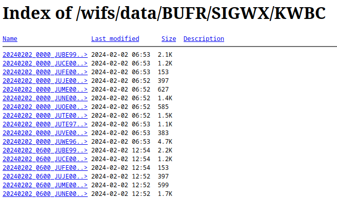
BUFR Files
The BUFR files are generated every 6 hours and the WIFS BUFR folder contains the past 36 hours of SIGWX forecasts in BUFR format. The figure below is an example of the files that can be found in this folder.
Snapshot of the BUFR folder
The file naming convention for these files is:
YYYYMMDD_HH00_TTAAii_CCCC.bufr
where
YYYY = 4-digit year
MM = 2-digit month
DD = 2-digit day
HH = 2-digit hour of forecast package valid time
00 = Fixed characters
TTAAii_CCCC = WMO header and site identifier
.bufr = File extension
Format of BUFR Files
For details on the format of the BUFR products see WMO Publication FM94 BUFR.
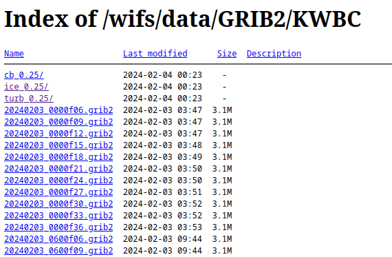
GRIB2 Gridded Files
Note: Starting in February 2024, new 0.25 degree grids are available via the WIFS API with 56 vertical levels up to FL600 and 39 forecast times out to T+120. These grids are not available on the legacy WIFS data pages. See the WIFS API page for more details on how to access these new grids.
The WAFS GRIB2 files are generated every 6 hours. The GRIB2 folder contains all the forecasts from the past 18 hours. The individual bulletins are concatenated together according to the forecast valid time. The figure below depicts an example of the files that can be found under the GRIB2 folder.
Snapshot of the GRIB2 folder
The file naming convention for GRIB2 files is:
YYYYMMDD_hhmmfFF.grib2
where
YYYY = 4-digit year
MM = 2-digit month
DD = 2-digit day
hh = 2-digit hour of model run
mm = 2-digit minute of model run
f = Fixed character
FF = 2-digit forecast hour
.grib2 = File extension
Format of Gridded Files
The gridded files are formatted in accordance with WMO code FM 92 (GRIB Version 2), and are described in full detail in "WMO Manual on Codes, Volume I, Part B (WMO No. 306).
Software libraries to decode data in GRIB2 data are provided by the National Centers for Environmental Prediction (NCEP), and can be found at:
https://www.nco.ncep.noaa.gov/pmb/codes/GRIB2/
Format of 0.25 Degree Gridded Hazard Files
These files are available both as a full global dataset and in regional subsets or tiles of data. Users are encouraged to think carefully about whether a regional tile (or two) meets their operational requirement, and to download those instead of the global grids to help reduce the overall volume of data. The figure below shows the areas covered by each regional tile.
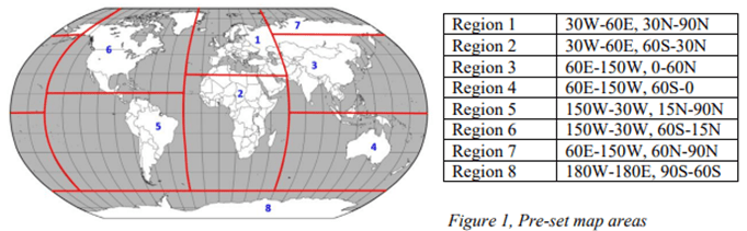
Pre-Set Map Areas
The below snapshot shows how the directory looks for the 0.25 degree hazard files. Note the eight smaller regional files.
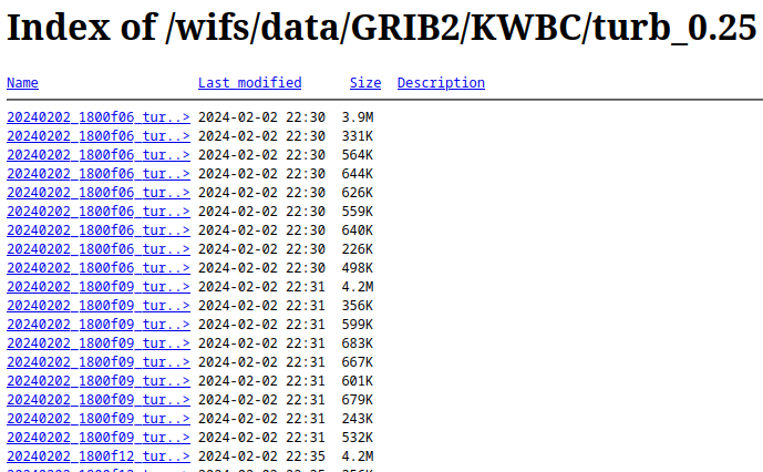
0.25 Degree Hazard File Snapshot
OPMET Alphanumeric Data Files
The WIFS server provides OPMET data (METARs/SPECIs, TAFs, SIGMETs, Advisories, PIREPs) in character-oriented format, often referred to as Traditional Alphanumeric Coding (TAC). These data are made available based on the following criteria:
- By the Hour
- By the Minute
- Rolling timeframes of the last 5, 30 and 60 minutes
OPMET-HOURLY
Each file within this folder contains all OPMET data that was received by NWS during a given hour. 36 hours of data are continuously maintained, and every hour a new file is generated from the most recent hour’s data, and the oldest file is removed from the WIFS server. The following figure depicts a snapshot of the files maintained in this folder.

Snapshot of the OPMET-Hourly Folder
The file naming convention for OPMET-HOURLY files is:
YYYYMMDD_hh_OPMET
where
YYYY = 4-digit year
MM = 2-digit month
DD =2-digit day
hh = 2-digit start hour of collected data
OPMET = Fixed text
OPMET-MINUTE
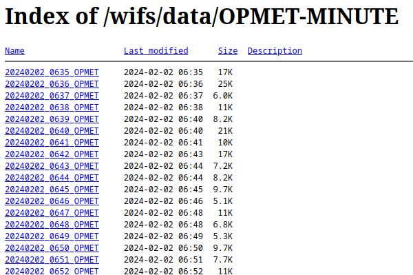
Each file within this folder contains all OPMET data received during a given minute. Thirty-six (36) hours of data are continuously maintained. Every minute a new file is generated from the most recent hour’s data and the oldest file is removed. The following figure depicts a snapshot of the files maintained in this folder.
Snapshot of the OPMET-MINUTE folder
The file naming convention for OPMET-MINUTE files is:
YYYYMMDD_hhmm_OPMET
where
YYYY=4-digit year
MM = 2-digit month
DD = 2-digit day
hh = 2-digit start hour of collected data
mm = 2-digit start minute within the hh hour of collected data
OPMET = Fixed text
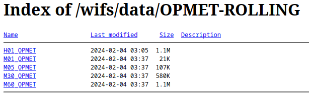
OPMET-ROLLING
There are five individual OPMET data files within this folder that are generated from the OPMET_MINUTE files.
Snapshot of the OPMET-ROLLING folder
- The M01_OPMET file updates every minute and contains the latest minute of OPMET data.
- The M05_OPMET file updates every minute and contains the latest 5 minutes of OPMET data.
- The M30_OPMET file updates every minute and contains the latest 30 minutes of OPMET data.
- The M60_OPMET file updates every minute and contains the latest 60 minutes of OPMET data.
- The H01_OPMET file updates just after the top of the hour and contains the previous 60 minutes of OPMET data updated at the top of the hour.
Format of OPMET Files
The OPMET files contain multiple WMO records are formatted in accordance with WMO Publication 386.
OPMET IWXXM Files
The WIFS server provides OPMET IWXXM data (METARs/SPECIs, TAFs, SIGMETs, Advisories) in XML format. These data are made available based on the following criteria:
- By the Hour
- By 5 Minutes
- By the Minute
- Rolling timeframes of the last 5, 30 and 60 minutes
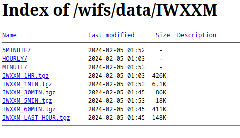
Snapshot of the IWXXM folder
IWXXM MINUTE
Each minute file file is a collection of products much like the alphanumeric data are. But to preserve the XML nature of the data, each product is put into a file by itself and then added to a tar file. Each minute tar file is a collection of products for that minute only. Then the tar file is gzip compressed. For example, the 20240205_0153_IWXXM_MINUTE.tgz contains:
-rw-r--r-- ldm/ops        4297 2024-02-04 19:53 LAUS23_KWBC_050200.xml
-rw-r--r-- ldm/ops        6845 2024-02-04 19:53 LAUS25_KWBC_050200.xml
-rw-r--r-- ldm/ops        9990 2024-02-04 19:53 LAUS21_KWBC_050200.xml
-rw-r--r-- ldm/ops        4096 2024-02-04 19:53 LAUS24_KWBC_050200.xml
-rw-r--r-- ldm/ops       11450 2024-02-04 19:53 LPUS23_KWBC_050152.xml
-rw-r--r-- ldm/ops       10513 2024-02-04 19:53 LPUS22_KWBC_050152.xml
-rw-r--r-- ldm/ops        4290 2024-02-04 19:53 LPUS24_KWBC_050152.xml
The files use the WMO header to define their content as:
- LA - METARs
- LC - TAFs short range
- LK - Tropical cyclone advisories
- LP - SPECIs
- LS - SIGMETs general
- LT - TAFs long range
- LU - Volcanic ash advisories
- LV - SIGMETs Volcanic ash
- LY - SIGMETs tropical cyclone
after uncompressing and untaring the file, the individual products may be viewed and decoded. If no new data comes in for a minute, no file will be generated.
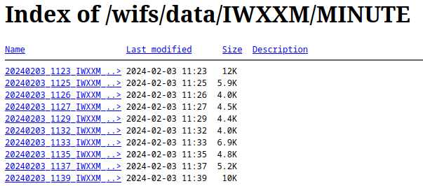
Snapshot of the IWXXM MINUTE folder
IWXXM 5MINUTE
The IWXXM 5 minute files are a collection of minute files which are then added to a tar file and gzip compressed like the minute files are. For example, the 20240205_0245_IWXXM_5MIN.tgz has in it the following minute files:
-rw-r--r-- ldm/ops        8495 2024-02-04 20:41 20240205_0241_IWXXM_MINUTE.tgz
-rw-r--r-- ldm/ops        1957 2024-02-04 20:42 20240205_0242_IWXXM_MINUTE.tgz
-rw-r--r-- ldm/ops        8371 2024-02-04 20:43 20240205_0243_IWXXM_MINUTE.tgz
-rw-r--r-- ldm/ops        8227 2024-02-04 20:44 20240205_0244_IWXXM_MINUTE.tgz
-rw-r--r-- ldm/ops        4610 2024-02-04 20:45 20240205_0245_IWXXM_MINUTE.tgz
So to get to the data, the tar file must be untar'd into its minute files. Then each minute file must be untar'd to get to the data. It's a 2 step process.
IWXXM HOURLY
The IWXXM hourly files are a collection of 5 minute files which are then added to a tar file and gzip compressed like the minute files are. For example, the 20240205_02_IWXXM_HOURLY.tgz has in it the following 5 minute files:
-rw-r--r-- ldm/ops       31766 2024-02-04 19:05 20240205_0105_IWXXM_5MIN.tgz
-rw-r--r-- ldm/ops       12327 2024-02-04 19:12 20240205_0110_IWXXM_5MIN.tgz
-rw-r--r-- ldm/ops       18917 2024-02-04 19:17 20240205_0115_IWXXM_5MIN.tgz
-rw-r--r-- ldm/ops       15570 2024-02-04 19:20 20240205_0120_IWXXM_5MIN.tgz
-rw-r--r-- ldm/ops       21336 2024-02-04 19:25 20240205_0125_IWXXM_5MIN.tgz
-rw-r--r-- ldm/ops        8305 2024-02-04 19:32 20240205_0130_IWXXM_5MIN.tgz
-rw-r--r-- ldm/ops       15707 2024-02-04 19:35 20240205_0135_IWXXM_5MIN.tgz
-rw-r--r-- ldm/ops       11107 2024-02-04 19:42 20240205_0140_IWXXM_5MIN.tgz
-rw-r--r-- ldm/ops       15843 2024-02-04 19:45 20240205_0145_IWXXM_5MIN.tgz
-rw-r--r-- ldm/ops       12085 2024-02-04 19:52 20240205_0150_IWXXM_5MIN.tgz
-rw-r--r-- ldm/ops       35997 2024-02-04 19:55 20240205_0155_IWXXM_5MIN.tgz
-rw-r--r-- ldm/ops      190237 2024-02-04 20:00 20240205_0200_IWXXM_5MIN.tgz
So to get to the data, it's the same as the 5 minute files except there is one extra step of untaring the hourly file into its 5 minute files.
IWXXM Rolling Files
The files are in the IWXXM root directory. The files have the following contents:
- IWXXM_1MIN.tgz - the latest 1 minute file
- IWXXM_5MIN.tgz - the latest 5 minute file
- IWXXM_30MIN.tgz - the last six 5 minute files
- IWXXM_60MIN.tgz - the last twelve 5 minute files (last hour)
- IWXXM_1HR.tgz - the last hourly file (twelve 5 minute files up to the top of the last hour)
- IWXXM_LAST_HOUR.tgz - all the 5 minute files since the top of the current hour (variable number of files in tar file)
Format of IWXXM Files
The IWXXM format is a standard for interchanging meteorological data using machine readable XML/GML. A XML definition, schema and examples are included in ICAO Annex 3. For more information, see the WMO IWXXM schema directory.
PNG Files
Portable Network Graphic (PNG) images of the Significant Weather ICAO area charts are stored in the PNG folder of the WIFS file system. The WMO messages in the table below are retained in the PNG folder for 36 hours.
Significant Weather PNG Files
| WMO Header | Area |
|---|---|
| PGEE05 KKCI | ICAO A |
| PGIE05 KKCI | ICAO B1 |
| PGGE05 KKCI | ICAO F |
| PGAE05 KKCI | ICAO H |
| PGBE05 KKCI | ICAO I |
| PGJE05 KKCI | ICAO J |
| PGDE29 KKCI | ICAO M |
| PGNE14 KKCI | North Atlantic Ocean Region |
ICAO Regions
Volcanic ash and tropical cyclone graphics in PNG format are also available when advisories are issued. These products will have a WMO header starting with PFXD (volcanic ash) and PZXD (tropical cyclone). The figures below depict snapshots of the files maintained in the SIGWX and VOLC folders, respectively.
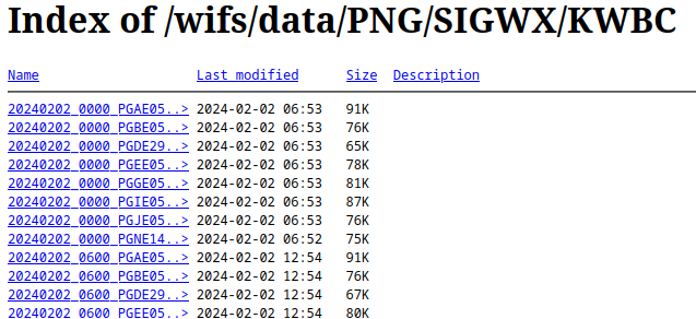
Snapshot of the PNG SIGWX KWBC folder
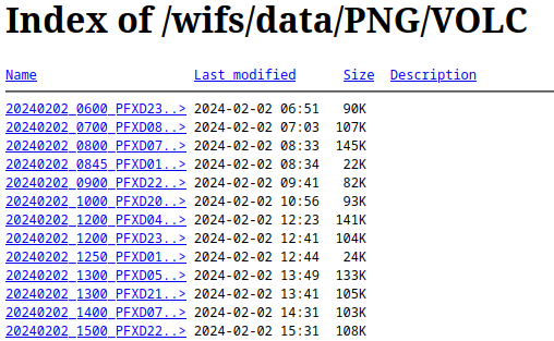
Snapshot of the PNG VOLC folder
The file naming convention for these files is:
YYYYMMDD_HH00_TTAAii_CCCC.png
where
YYYY=4-digit year
MM = 2-digit month
DD = 2-digit day
HH = 2-digit hour of forecast package valid time
00 = Fixed characters
TTAAii_CCCC = WMO header and site identifier
.png = File extension
Format of PNG Files
For detailed information on the PNG format, see the W3C Portable Network Graphics (PNG) Specification (Second Edition) (https://www.w3.org/TR/PNG).
ADMIN_MSGS
Administrative messages are retained on WIFS for 36 hours. Each file contains a single message. The figure below is a snapshot of the administrative messages found on the WIFS servers.
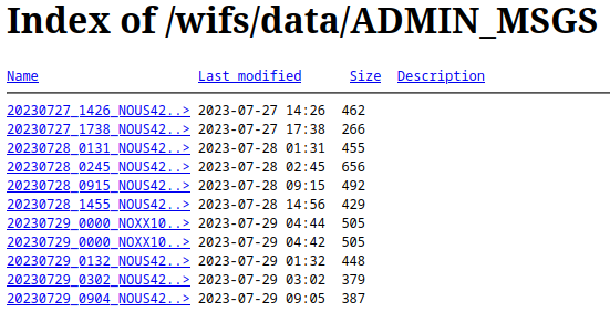
Snapshot of the ADMIN_MSGS folder
The file naming convention for these files is:
YYYYMMDD_hhmm_TTAAii_CCCC.adm
where
YYYY = 4-digit year
MM = 2-digit month
DD = 2-digit day
hh = 2-digit hour of message issuance time
mm = 2-digit minute of message issuance time
TTAAii_CCCC = WMO header and site identifier
.adm = File extension
Format of Administrative Message Files
The Administrative message files contain a single WMO record formatted in accordance with WMO Publication 386.
Announcing Changes in Services or Products
Any routine changes to the WIFS Directory structure, content, or the formats of the WIFS files will be communicated at least 30 days in advance of the scheduled implementation via an “NOXX10 KKCI” Administrative message and to the user’s registered email on file. In addition, requirement changes that are agreed upon and announced at the ICAO Met Panel (Working Group-Meteorological Operations Group) and other regional meetings may result in modifications to the file content and data structure. Examples of new WIFS content and formats will be made available for WIFS User testing to identify any impacts to user WIFS processing or display systems.
WIFS Customer Support will be available to assist WIFS Users in resolving any issues with user logins, data timeliness, and network outages.
Frequently Asked Questions
Can you recommend a vendor I can contact?
While we can not recommend a specific vendor, we maintain a list of vendors on the WIFS web page. Please see the support tab for more information.
I contacted the vendor for support and we can not afford their services as we have no budget for the proposed estimated cost. Is there an alternative for me?
One option is to develop your own application to download and visualize the data. Another option is to use freely available packages such as Gempak or Grads (see below). For more information on downloading and data, please reference the WIFS User's Guide under API.
I don't want to use a vendor. What free software do I need to access WIFS and display the information?
For instructions on acquiring the data, please reference the WIFS User's Guide. The data retrieval process is described in API and Legacy. An alternative retrieval method is to point your web browser to http://www.aviationweather.gov/wifs/data, log in with your WIFS credentials, and download the file(s) of interest via your web browser.
For displaying the data, you will need the ability to decode and then render GRIB2 and IWXXM formatted files. There are several freely available packages that perform this function:
NCEP decoding libraries (no display functions): https://github.com/NOAA-EMC/NCEPLIBS-g2c
Note that none of the above packages are uniquely tailored to support an “off the shelf” WIFS solution. You will have to set up and configure the software without support.
When I connect nothing happens.
If you are using vendor-supplied software, please contact your vendor for technical support. Otherwise please consult the User Troubleshooting Guidelines in the WIFS Users Guide available online found on the support tab.
I can pull the data in but nothing is displayed.
If you are using vendor-supplied software please contact your vendor for technical support. Otherwise please compare the size of the downloaded file with that on the WIFS web site. To do this point your browser to http://www.aviationweather.gov/wifs/data and enter your credentials in the login box. Then point and click on the folder of interest, find your file and take note of the size. If the size is different something went wrong during the download. Please download the file again. If the file size is the same please download a different file and see if it is displayable. If it is not displayable, the problem is likely in the display software. If it is displayable, the original WIFS data file may be corrupt and you are asked to notify the WIFS Help Desk.
How long should it take to pull in the files. It appears that the system is taking forever.
Transfer speeds are very site specific. Internet connections must be fast enough to handle the amount of data needed for the application.
In designing WIFS, most data files are partitioned so that they are not too large to be downloaded. Care was taken to provide only the necessary data and eliminate redundant or duplicate data. Even with that, these data files are not small and sites with slow or intermittent Internet connectivity can have significant delay in downloads. To avoid losing WIFS access privileges, a good rule of thumb is to not download data more frequently than it is updated.
OPMET data is available in three files. One is updated every hour, the other every five minutes, and the third every minute.
GRIB2 data is updated every 6 hours.
Do I need to uncompress the files before I can display them?
The WAFS products are already compressed or encoded to reduce size. If you are using software provided by your vendor, the files will be automatically decoded and processed.
OPMET data has products in METAR (surface observations), TAF (aerodrome forecasts) and SIGMET (significant weather forecasts) formats. Gridded data are in GRIB version 2 format. Significant Weather (SigWx) are in IWXXM format. All formats are defined by WMO (World Meteorological Organization) standards. Here are some links to formats and coding:
- http://www.wmo.int/pages/prog/www/WMOCodes.html (specifically look at volume 1.2 on binary codes for GRIB)
- http://www.nco.ncep.noaa.gov/pmb/docs/grib2/ (NCEP documentation on GRIB2)
- http://www.lima.icao.int/eDocuments/MET/OTHERS/SigmetGuide2010.pdf (CARSAM ICAO SIGMET guide)
I am missing OPMET files. What happened?
If you are using vendor-supplied software, please contact your vendor for technical support. Otherwise, please check the WIFS web site to see if the data is up-to-date. Browse to http://www.aviationweather.gov/wifs/data and use your WIFS credentials to log on. Once you are logged on click on the OPMET-MINUTE folder. These files are updated every minute. If you see up-to-date files on the web site, then the problem is likely related to something on your system (network connection, incorrect download command, etc.). Please retry your download command. If it fails again, send the command you are using along with any diagnostic output including errors to wifs.admin@noaa.gov.
I have access to SADIS. Do I need WIFS?
If you are a SADIS primary user, you may use WIFS as a backup data source. Register for a WIFS account and indicate you have a SADIS account in the comments.
I have access to WIFS. Do I need SADIS?
If you are a WIFS primary user, you may use SADIS as a backup data source. See the WIFS User's Guide and follow the procedures outlined for establishing a SADIS backup account. See the SADIS User's Guide for details on the SADIS file structure and access.